
On This Page
Study Summary and Goals
The Independence Heights/Northline Study provides analysis and recommendations for land use and infrastructure investments that create a more walkable, connected community with strong community hubs and great public spaces. Specifically, the study recommends:
- Redeveloping the historic Burgess Hall as an anchor for the community.
- Creating development guidelines that determine what can and cannot be constructed in the floodplain, and identifying key infrastructure in the floodplain that could be elevated.
- Building greater connections throughout the neighborhood by encouraging transit-oriented development at the Northline Transit Center and creating new pedestrian connections underneath I-45.
Download the Independence Heights-Northline Livable Centers Study and the Independence Heights-Northline Projects.
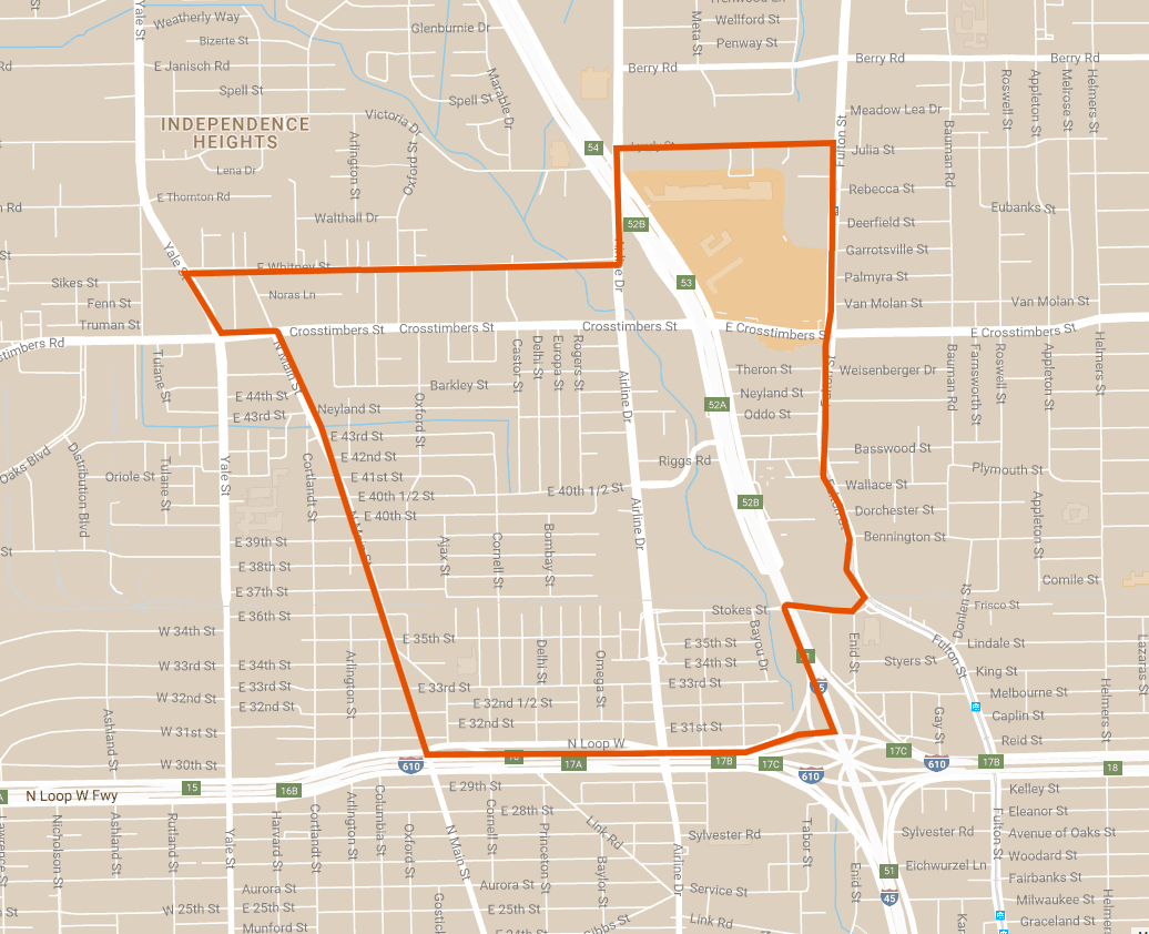
Study Area Map
The study area is bounded approximately by Whitney Street and Lyerly Street to the north, I-610 to the south, Fulton Street and I-45 to the east, and Yale Boulevard and North Main Street to the west. The main areas of focus are the Independence Heights area west of I-45 and the Northline Commons area.
Click for a larger image.
Local Partners
Greater Northside Management District
Independence Heights Redevelopment Council
Northline Development
Lead Consultant
Design Workshop